Tu correo electrónico ha sido enviado.

Land off Cheddon Rd Terreno de 5,4 ha - Residencial - en Cheddon Fitzpaine TA2 8LA
Parte de la información se ha traducido automáticamente.
Aspectos destacados
- Prime greenfield development site
- Freehold interest
- Approx 3.5 miles to Junction 25 of M5 Motorway
- Outline planning permission for up to 112 dwellings
- Edge of town location
Resumen ejecutivo
The seller owns the freehold interest of the site with title absolute and all the land is registered. The site comprises part of title number ST267663, part of title number ST266362 and the whole of title number ST94750.
The proposed residential development area is 7.78 acres (3.15 ha), of which the one-storey zone along the northern edged is 1.63 acres (0.66 ha). The latest version of the Development Framework Plan is shown opposite.
Información del edificio
| Tipo de venta | Inversión | Tipo de inmueble | Terreno |
| Tenencia | Plena propiedad | Subtipo de inmueble | Residencial |
| N.º de terrenos | 1 | Tamaño total del terreno | 5,4 ha |
| Tipo de venta | Inversión |
| Tenencia | Plena propiedad |
| N.º de terrenos | 1 |
| Tipo de inmueble | Terreno |
| Subtipo de inmueble | Residencial |
| Tamaño total del terreno | 5,4 ha |
1 Terreno disponible
Terreno
| Tamaño del terreno | 5,4 ha |
| Tamaño del terreno | 5,4 ha |
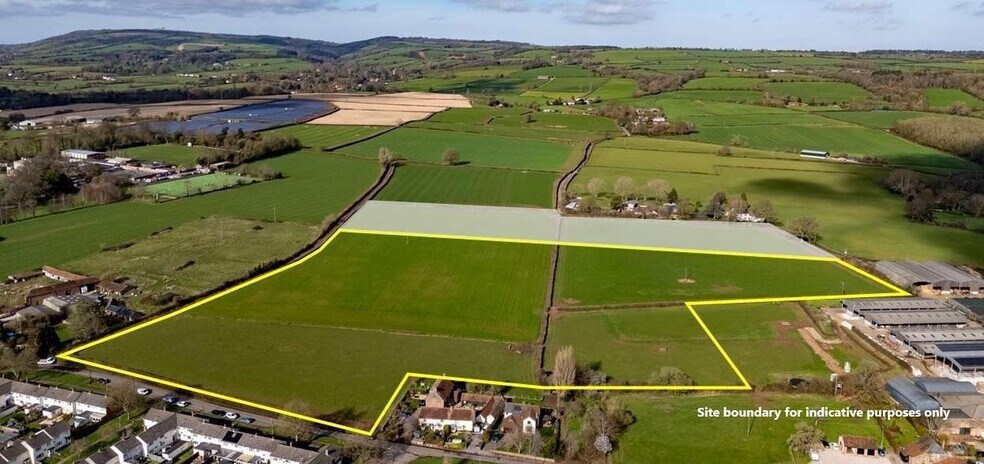
Prime, edge of town greenfield residential development opportunity with outline planning permission for up to 112 dwellings. The extent of the land for sale is edged red on the site plan and extends to approximately 13.34 acres (5.4 ha).
Descripción
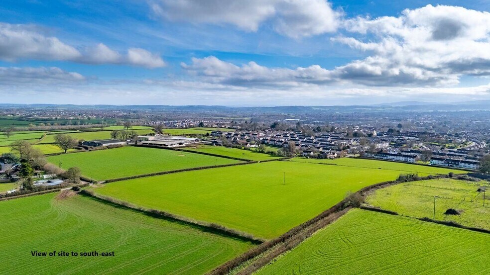
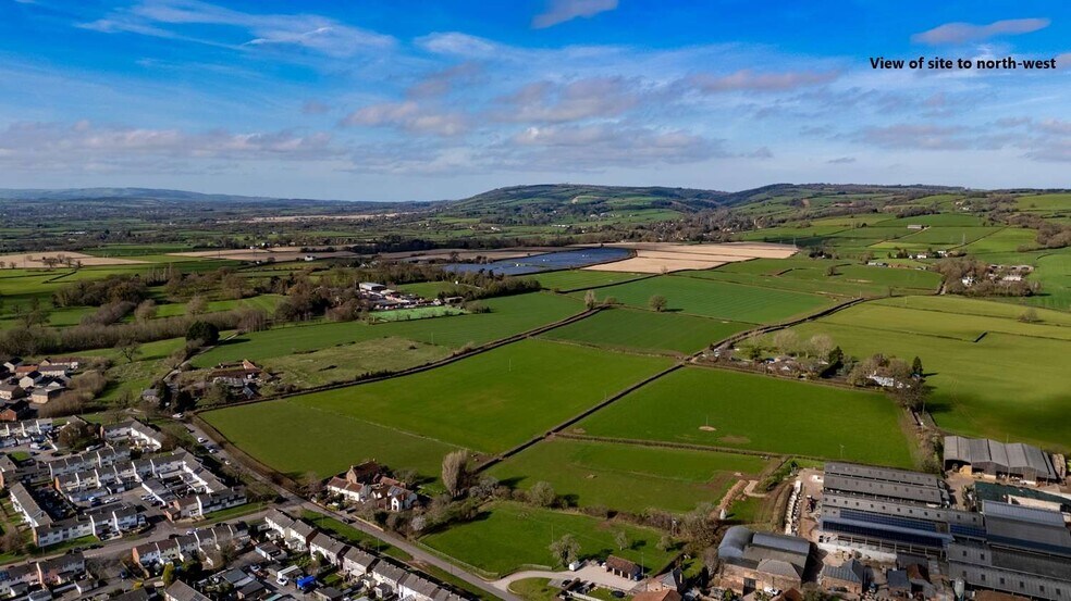
The extent of the land for sale is edged red on the site plan and extends to approximately 13.34 acres (5.4 ha). The red line site boundary differs to the planning application site for the reasons set out in the planning section below. The site is situated on the northern edge of the built-up boundary of Taunton. The land falls within Flood Zone 1 and is currently in agricultural use. Cheddon Road abuts the southern boundary of the site and Cats Lane, which is a public footpath that joins Cheddon Road, runs along the western boundary. Pyrland Farm and agricultural land lie to the immediate east of the site. The land adjoining the northern boundary (which falls within the planning application site) will be retained by the seller as agricultural land. The subject land is gently sloping with hedgerow field boundaries. The proposed entrance to the development is approximately half a mile to the popular Cheddon Fitzpaine Church School to the north-east of the site (Ofsted Report: Good (March 2024)) and within a third of a mile of King’s College Prep School to the west. Wellsprings Leisure Centre is in close proximity to the south-west. Taunton is the county town of Somerset and serves as the region’s primary hub for governance, public services and civic administration. With a population of over 63,000 (2021 census) and serving a much wider rural and regional catchment, the town functions as Somerset’s largest and most economically active settlement. Taunton benefits from excellent transport links, with a mainline railway station providing direct services to Bristol Temple Meads, Exeter St Davids and London Paddington. The site is situated approximately 3.5 miles from Junction 25 of the M5 motorway, which provides access to Bristol and the M4 to the north-east and Exeter and the south peninsula to the south-west. Bristol Airport is located approximately 37 miles to the north-east and provides scheduled and chartered flights to a wide range of national and international destinations. As well as excellent road and rail connectivity, Taunton is set within an attractive rural hinterland being within the Vale of Taunton Deane and surrounded by the Quantock, Blackdown, and Brendon Hills.


Elaborado por
Land off | Cheddon Rd
Parece que se ha producido un error al enviar tu mensaje. Vuelve a intentarlo.
Gracias. Se ha enviado tu mensaje.